Last updated:Today at 05:29
Train companies affected:Avanti West Coast, TransPennine Express
Last updated:Today at 00:04
Train companies affected:National Rail
Advertisement
You can view and download a variety of maps, including those for routes, stations and accessibility
Wherever you want to travel by train in Great Britain, on this page you can find a range of maps for the whole National Rail network, including:
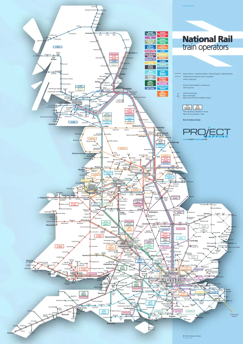
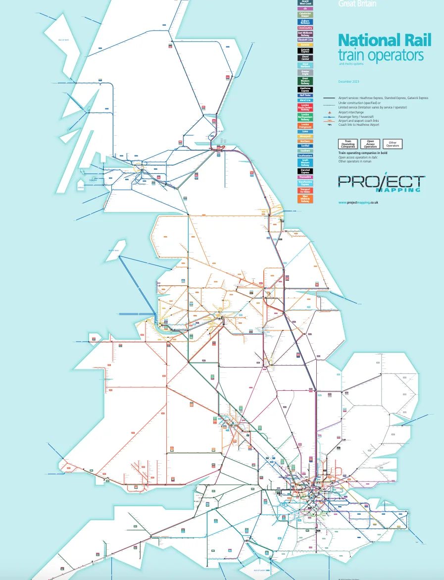
National route maps
Train operator maps
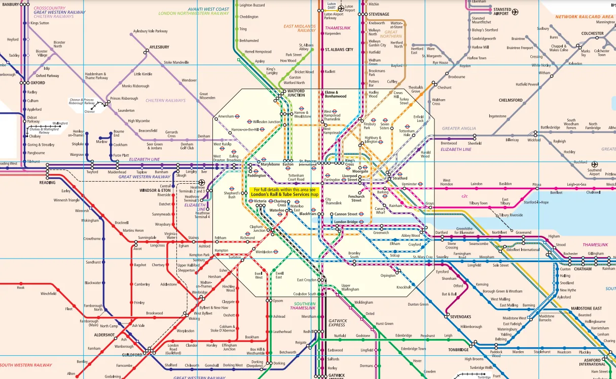
London and the South East maps
Interactive accessibility maps
Regional maps for England, Scotland and Wales
To find more information about a particular station, visit our Find a Station page.
Map of all National Rail routes and stations in the South East, also showing the Network Railcard area (February 2025 edition. PDF, 1.5 MB)
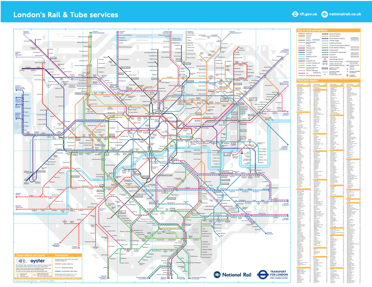
Map of all National Rail, London Underground, DLR and London Tram routes and stations within the Greater London area and beyond. (September 2024 edition. PDF, 369k)
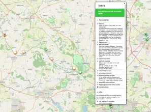
A zoomable interactive map showing the accessibility status and features for all National Rail served stations. Use the 'find station' feature to zoom into your station then click on the pin to open up the information.
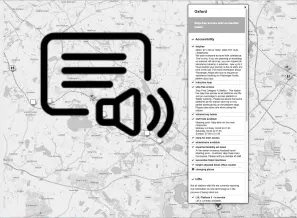
A text-only version of the Accessibility Map suitable for those using screenreaders to hear the accessibility status and features for all National Rail served stations.
Schematic map showing the rail routes around Birmingham and the West Midlands area. December 2024.
PDF (244k)
(download link)Schematic map showing the rail routes around the Derby and Nottingham areas. December 2023.
PDF (210k)
(download link)Schematic map showing the rail routes around the Leeds and Bradford areas. June 2024.
PDF (258k)
(download link)Schematic map showing the rail routes around Liverpool and the Merseyside areas. December 2024.
PDF (231k)
(download link)Schematic map showing the rail routes around the Greater Manchester areas. December 2023.
PDF (237k)
(download link)Schematic map showing the rail routes around the Newcastle and Sunderland areas. December 2024.
PDF (264k)
(download link)These maps show the local area around National Rail stations, and also include onward travel information such as bus routes, taxi ranks and cycle hire. They are not available for all stations.
To find local area maps, visit our Find a Station page and enter the name of the station you require. If there is a link called Onward Travel Information Map then local information is available.
Advertisement
© Copyright Conditions. Copyright for the maps on this page belongs to the organisation as shown on each map. All rights reserved. Except solely for your own personal and non-commercial use, no part of a map may be copied or used without the prior written permission of the copyright holder. By following a link to the map it is understood that you have read this notice and accept the conditions.